Region: Azores
Country: Portugal
Website: http://furnas.citi.pt/index.php?ambiente=spracores
Partner in charge of the site: SPRAZORES
Responsible name: Silvia Jorge
Site characteristics
Altitude (m): 515Topography: low slope
Orientation:
Slope (%): 0.0
Hydrology: medium drainage
South containment: 0
Soil type:
Parent rock:
PH: 5.7
Climate
Average temperature (°C): 12.5Average precipitation (mm): 2400
Reference period for climatic data: 1976-2013
History of the site
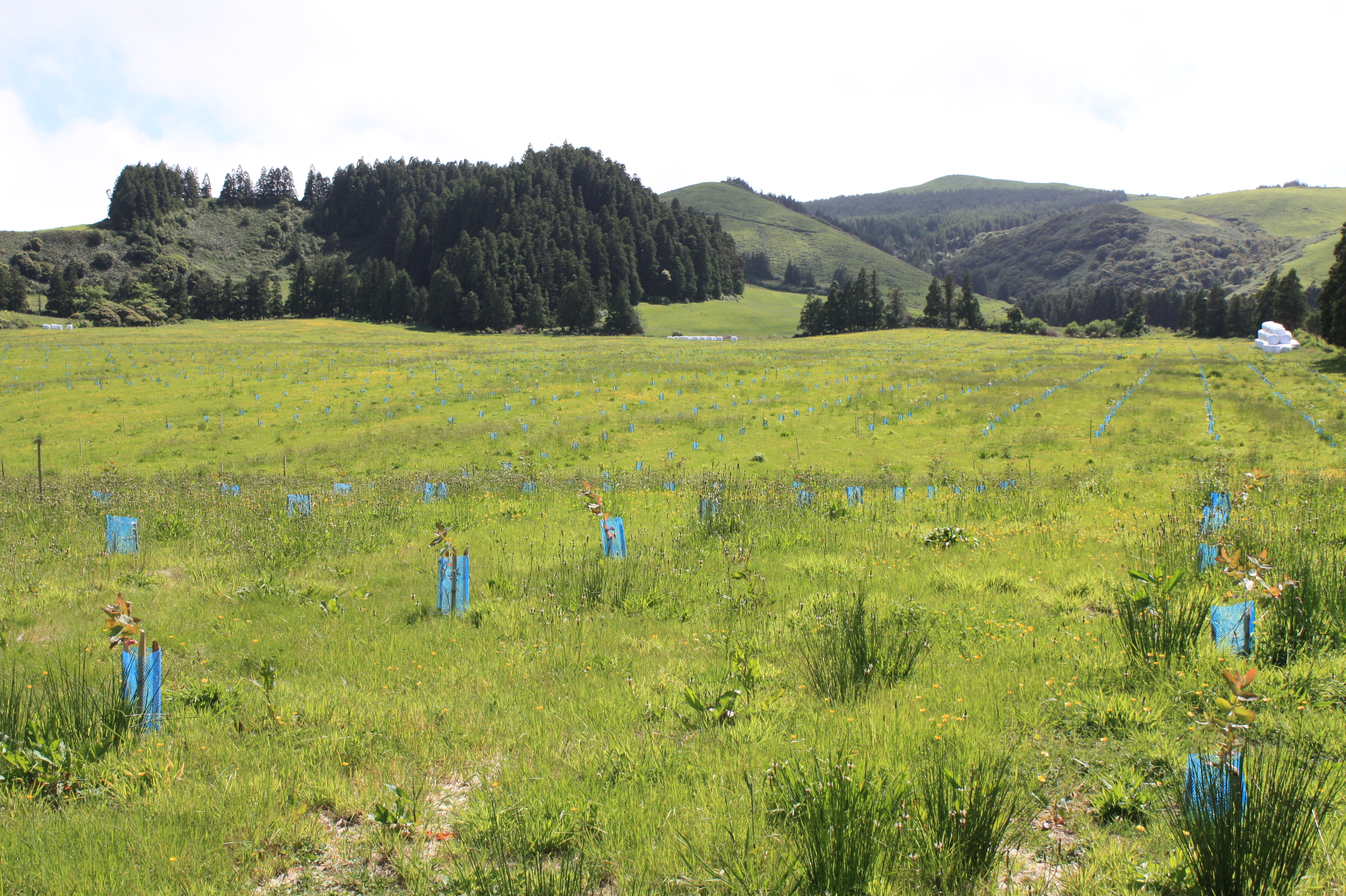
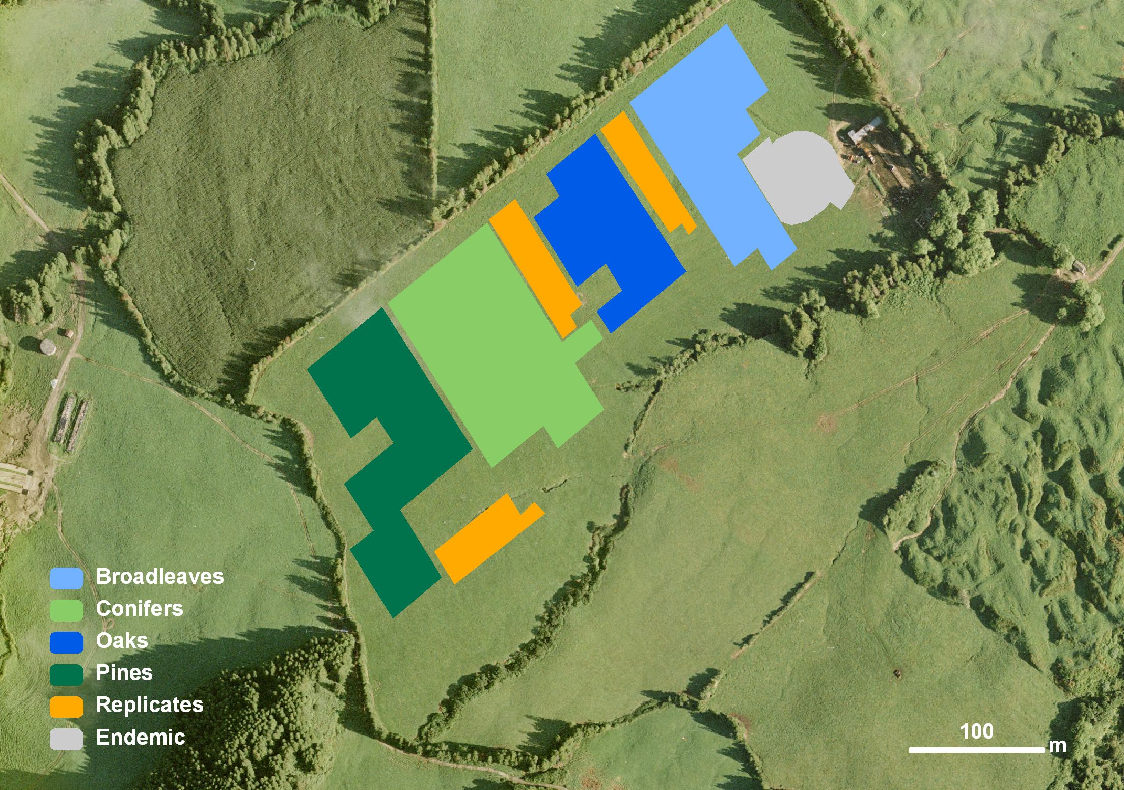
This site would initially be covered with natural forest, which was later removed, and heavy machinery eliminated its preexistent microtopography for pastureland, therefore creating erosion problems due to the concentration of water across the pasture. This pasture was part of a semi-intensive dairy farm with heavy fertilizations for the past three decades. At the lower part of the pasture there was also a concrete construction where the cattle was milked and feed. This concentration resulted in a large degradation of part of the pasture, which needed to be avoided, not to influence the arboretum results. After purchasing the area, from privates, to implement Furnas Lake watershed basin ecological restoration, cows were removed, fertilizations completely stopped, all litter cleaned up and part of the cow dung was also removed. There was a control of invasive species in the center (ex. rumex) and borders (ex. rubus, etc…) of the parcel, which was only mildly invaded. Afterwards the entire pasture was seeded with a flowering meadow, where clovers where the dominant species, in order to experiment phosphorous removal from the soil and sustainably increase grass yields. This site was chosen due to its large extension and possibility to increase the arboretum in the future, and its deep rich soils. It also assures a reasonably easy accessibility due to its proximity to a dirt road. Later the pastureland was planted with the Reinfforce arboreta, therefore integrating Furnas Landscape Laboratory. Each provenance counts with 50 plants, on a compass of 3x4 m. Permission to make use new forestry species was conceded by the Regional Directorate for Nature Conservation, and reconfirmed by the regional director of environment.Publications related to the site
6121937
AR38
1
apa
50
default
2564
https://reinfforce2.plantedforests.org/wp-content/plugins/zotpress/
 copyrigth IEFC network